About the Bluewren Photos Suite…
For more than a decade the Bluewren Partners team have been developing the Bluewren Photos Suite that can capture site conditions for near immediate remote access with a classification system to allow for ease of future referencing.
The Suite makes virtual site visits possible from a desktop or most phones / tablets (Android or iOS) with an internet connection. Images are captured, classified and uploaded to allow viewing providing timely issue resolution and specific images and other information to be available without the need for a site visit.
The big advantage of the Suite is that photo records can be captured by as many users as authorised and aggregated into the same pool of photo records known as a Photo map. Images may be captured and uploaded simultaneously by multiple users. The combined photo records are then available for reference and search or filtering immediately, and into the future using a unified classification system.
After initial setup using the Bluewren Manager, the Photo Record Tool App is used in a guided, easy work flow to take a photo, then verify the location and angle of view against the aerial map and classify it via a tagging system. Relevant comments can be included to assist future photo finding.
The image and associated logged information (comprising a photo record) is uploaded to the cloud with a single touch and further images can be captured and classified concurrently with upload. The cloud information includes a database linked to the images for fast filtering and targeted searches to speed up finding relevant images.
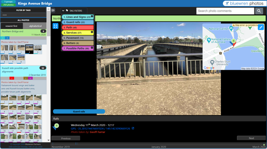
When viewed using the Photo Viewer the location markers for photo records are arranged on a satellite map of the project site and may be superimposed on plans (overlays) and photo records captured at other times to check on relative progress or changed conditions over time. The Editing Tool may be used to amend any of the logged information if required, we are all human after all….
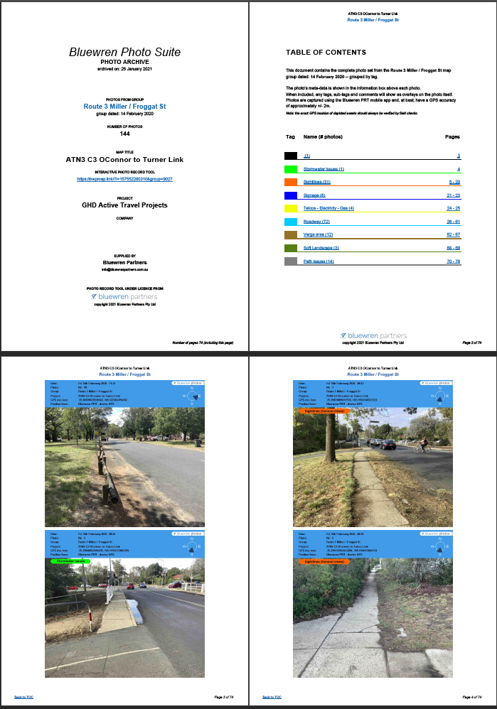
At completion or at any time during the project the captured and classified images can be downloaded as a PDF report or in electronic format (jpegs) as an Archive with just the .jpegs or as a Photo Album, a local html based viewer (no .exe) with all .jpegs and database information to provide the same functionality of search and filtering as the online viewer.
Bluewren Manager
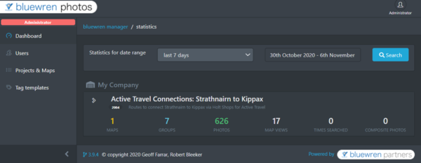
The Bluewren Manager is the administration interface that allows for people to be invited to create maps, choose tag sets for classification and other information for the effective use of the Suite.
Administration
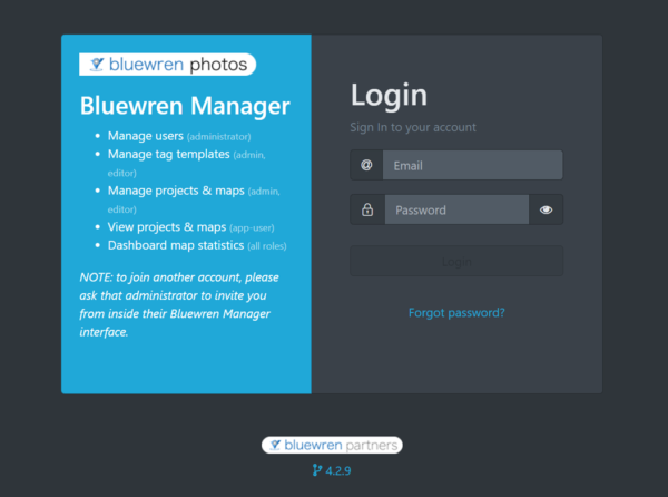
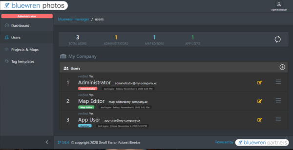
A single administrator sets the access levels for people who are to capture and edit information and images. People are invited to a project or photo maps with an access level of map editor or app user. Once invited people can set a password and through using their email address as the user name, log in to the Bluewren Manager and after initial set up and installation of the Photo Record Tool App, start photo recording.
All invited people have access to the Bluewren Manager but with different permissions to create and edit photo maps, images and associated information. The administrator chooses which projects or photo maps that map editors and app users can access.
Initial set-up
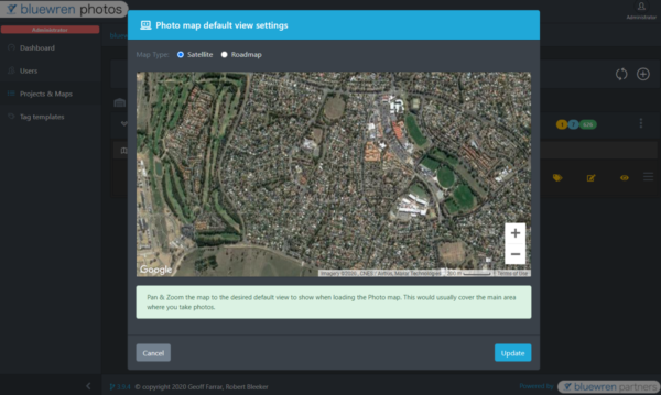
Prior to taking pictures using the Photo Record Tool App the default map position for photo viewing and the photo classification system should be set-up. Any plan overlays and high resolution aerial maps can also be included.
Photo record classification system
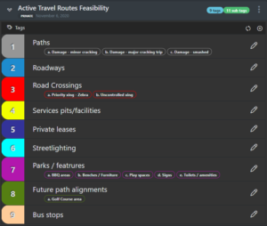
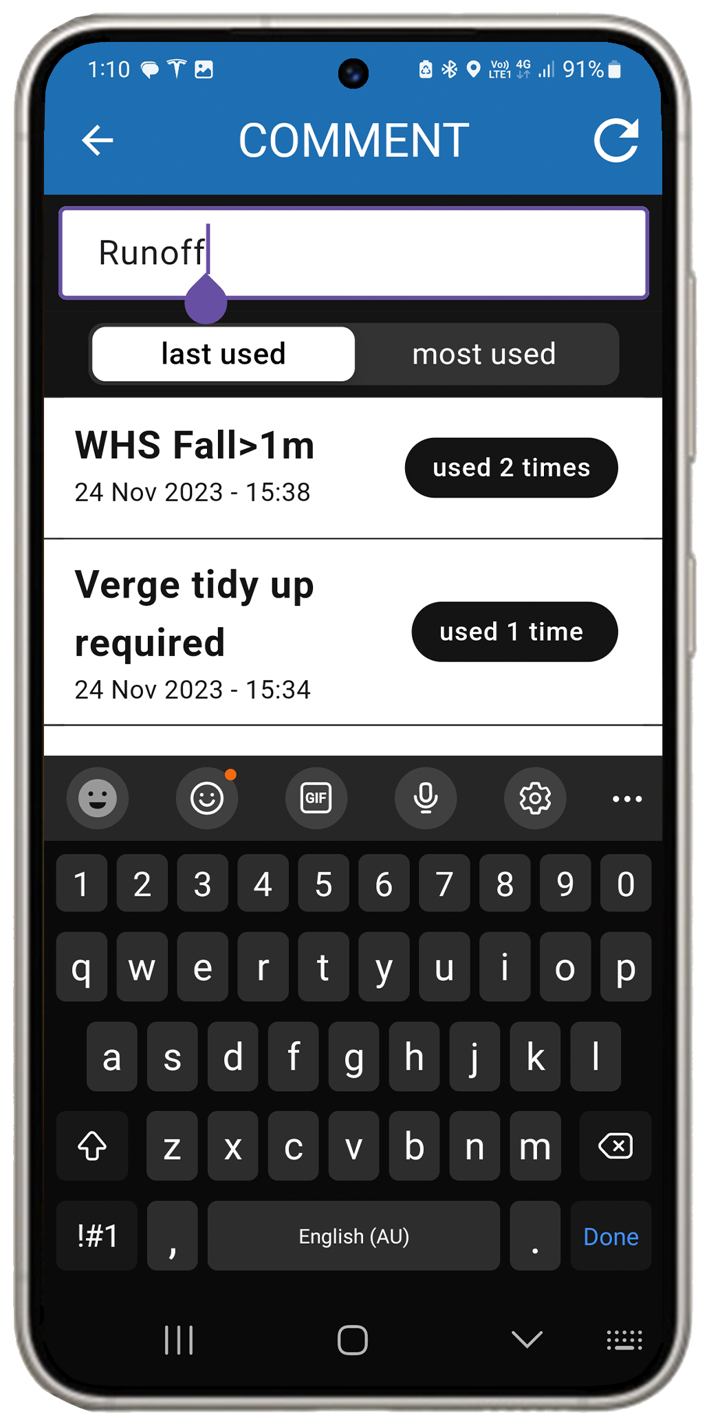
When captured photos are referenced to a particular Photo map which is part of a Project, projects may include a single or multiple photo maps. Each Photo map may include a tags set of tags and sub-tags which are created by the administrator at commencement through the Bluewren Manager or copied from a previous photo map. There are 10 tags each with 5 sub-tags available, and as many, or few of these may be used in a photo map. To get going quickly a tags set may also be copied from one of the publicly available project relevant sets. Comments may be typed directly into the comment entry box or the previous comments are available for selection at a touch for quick editing to save on typing time. These may be sorted by most used or last saved.
Photo Viewer access
Use of the Suite. for viewing images including searches to identify photos is available to anybody with an internet connection though using the individualised link to a Photo map. The administrator may include a PIN for additional security and access links may be date limited or disabled at any time.
Access to all of the features of the Suite including the Editing Tool and Photo Viewer are available through the Bluewren Manager. The Photo Record Tool is a separate App and not available through the Bluewren Manager.
Tap or click here for further information on how to use the Bluewren Manager.
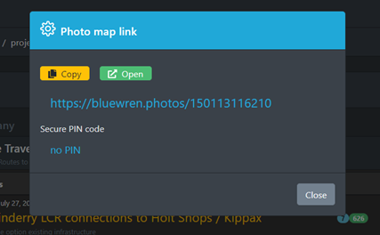
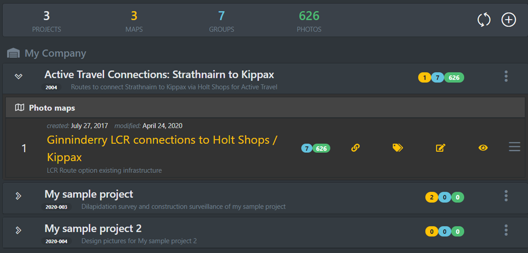
Photo Record Tool (PRT) App
After setting up a password through an invitation Email from the administrator, and downloading and installing the Bluewren Photo Record Tool (PRT) App from the Google or Apple store onto a phone or tablet, you should be ready to go…
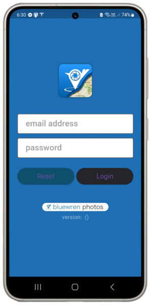
Launch the installed Bluewren PRT App and log in with the Email address (the invitation was sent to) and the created password. The PRT will ask for permissions to use the camera, location services and keyboard etc. make sure to hit OK for all of these permissions to enable full functionality. You should then be able to select the project and relevant photo map (as set up by the administrator) and create a photo group or select an existing photo group. We recommend creating a new photo group for each day images are captured on site, however if there are a number of smaller sites or for other reasons, photos can be added to an existing group.
Smart image capture and classification
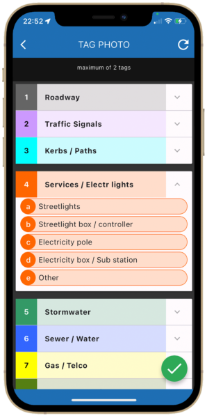
Key information is logged during image capture through use of an easy and quick workflow to create photo records. Photos are taken, location and angle of view checked and adjusted as necessary, tags and sub-tags are then included via one touch selections.
A maximum of approximately 200 photos per group is advisable for efficient viewing, identification and archiving. If more images are expected in a day another group may be created for a different area or tag grouping.
Flexibility in how it works
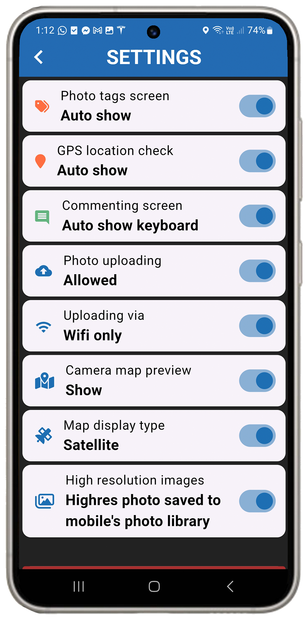
You may adjust a number of interface features to suit how you may wish to capture information including how the map is shown on the camera view, if at all, automatic show of the photo tags screen after image capture and other features related to upload timing and image storage. For example the App can be set to store a high res image on your phone for use with other Apps or to only upload images with photo records directly to the cloud.
Tap or click here for more information on how the PRT may be adjusted to best meet your needs. (The default settings are shown in the example).
Location and view angle verification
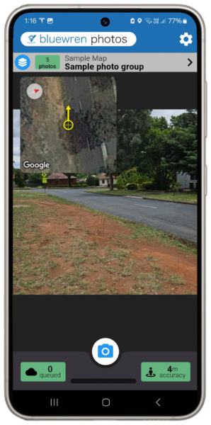
GPS location can be influenced by proximity to buildings and sometimes may be randomly unreliable. GPS chips in some phones and tablets may also not allow for the desired location accuracy without adjustment. To address the risk of inaccurate image positioning the capture workflow includes a step to enable adjusting the position and angle of view of the captured image against the satellite map.
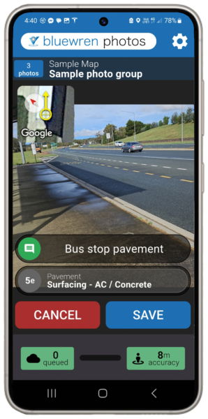
The principal positioning confidence comes from the calculated location accuracy shown in the green square on the bottom right of the screen. Angle of view is indicated by the yellow arrow with the image location at the centre of the cross hairs.
You can choose to wait until the location accuracy resolves to approximately 4-6m before taking photos, or if your GPS chip does not provide this level of accuracy, or your perceived position and rotation is different from viewing your surroundings compared to the satellite map, you may change both the position and view angle of rotation prior to accepting the location and angle of view in the satellite map pop-up that appears after taking the photo. Tapping reset will move the location and angle of view back to the “as-taken” position.
Tags sets ideally require previous set-up through the Bluewren Manager with 10 tags and 5 sub-tags available. These may be copied from public sets or from other projects and modified or created from scratch. Tags and sub-tags can be created later and previously taken photo records easily amended to include tags and sub-tags if necessary. Photos from other devices may also be added to Photo groups using the Editing Tool
Comments may be added prior to save/upload with all previous comments available for direct use by scrolling and selecting or previous text modified to minimise finger time. Comments may be sorted for selection by last or most used
Tip: Carefully consider comment of the various features to allow easy identifiaction of images in future through key work or phrase searches.
Upload and viewing
Once the location is confirmed and image classification is completed with comments added as desired, a tap on the “save” button will upload the image and associated information to the cloud with progress shown on a blue bar at the bottom of the screen. As many photo records as necessary may be queued for upload depending on the rate of photo record creation and the bandwidth available at your particular location.
Photo records may be queued for later upload using Wi-Fi if this is preferred (if mobile data is not activated). High res images may be stored on your phone for use with other Apps or uploaded to the cloud only to avoid clogging your phone storage.
The number in the green box at the bottom left corner shows the number of queued images. Once uploaded images are available for viewing through the Photo Viewer almost immediately by any authorised person with internet access.
Tap or click here for more information on how to use the Bluewren Photo Record Tool.
Photo Viewer
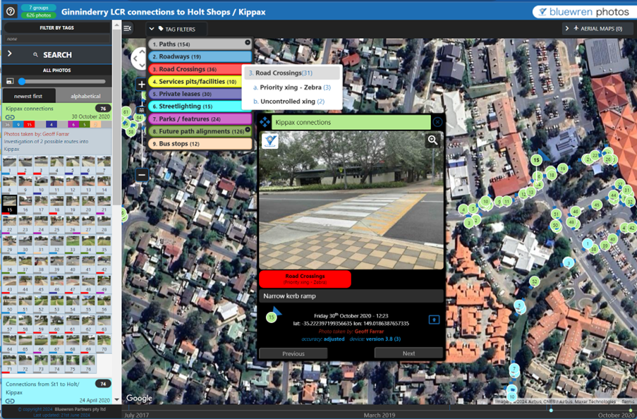
The Photo Viewer is the interface where images may be viewed shortly after being captured and searches and filtering of the information stored with the photo records undertaken to quickly find relevant photo records in future referencing. Filtering may be by any combination of tags and subtags along with searches on location within a radius of a selected point, dates and key words included in comments.
The range of helpful features that have been developed from feedback over many years of service make the interface as intuitive and useful as possible. The latest development is the inclusion of mini thumbnails for each image on the side bar. The guide that includes details and tips on how to get the best out of the Photo Viewer is available here.
Editing Tool
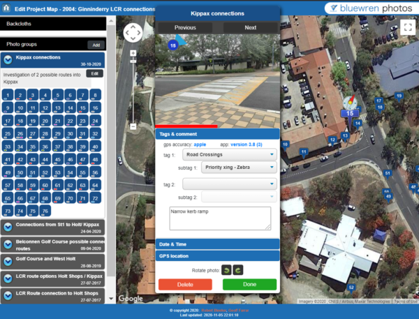
Sometimes photos and their associated information may need to be amended from the information logged at capture through the Photo Record Tool App. The Editing Tool provides an easy way to do this and is accessed for each photo map via the Bluewren Manager. Editing of photo group names and notes as well as photo properties and information is possible including:
- tag and sub-tag (select from those already included in the tags set)
- comments
- date and time
- position and angle of view
The Bluewren Manager allows for amendments to the tags set and other Photo map properties such as overlays and aerial maps. Deleting a tags set that includes photo records is not recommended.
Photo record reports, archive and photo albums
At any time during the project Photo maps information may be downloaded through the Bluewren Manager interface as:
- pdf booklet that includes sorting based on tags / sub-tags and hyperlinks from a table of contents. The report provided is per photo group; NO CHARGE
- Archive (jpegs) Usally undertaken at the end of a project when only the .jpegs may be required. Photos are arranged in a directory structure that matches the Photo map with photos filed in directories to match the photo groups.
CHARGE - Photo Album (jpegs and classification database) Information is arranged in a directory structure that matches the Photo map with photos filed in directories to match the photo groups. An special photo viewer with a look and feel very similar to the Photo Viewer is included that enables viewing of photo records off-line positioned on a google map background with photo angle of view and comments. Filtering of images is available through the special viewer based on tags and sub-tags if present. A search tool for comments is part of the special off-line viewer, distance and time search functionality is not included.
Downloadable via a provided link. Can be shared with clients or others.
CHARGE calculated from the number of records in the photo map.
Downloading the photo records electronically along with the portable off-line viewer as a Photo Album at the end of a project allows for an enduring reference to be kept on a private server with the ongoing functionality of being able to view and identify images using any html browser with search and filtering of the classification information into the future. The GPS positioning and angle of view is saved as EXIF data within the jpeg file. The tags, sub-tags and comments are saved within the database files and the full-size image jpegs as well as thumbnails are included.
An archived Photo map may be reactivated in cloud storage for both capture and classification of more images or for viewing and identification of photos using the full functionality of the Photo Viewer for a period of 2 years after archiving. Photo records may also be deleted at the completion of a subscription if this is required.

